The Ginninderry Conservation Trust
August 2023 - Ongoing.
I was transferred from Wildbark at Mulligans Flat to the affiliated Ginninderry Conservation Trust to lead the development, design and implementation of a wayfinding system and body of interpretive signage for a new nature walking track network spanning 280 hectares of land.
Responsible for operating within a $1.6 million dollar budget for track development and placemaking in the nature reserve, my role involves making decisions around signage types and positioning, mapping and illustrating, and determining ways to communicate the stories of the landscape to visitors and the local community.
My project management role has involved overseeing the entire process from start to finish. This has included creating the initial scope of works, sourcing materials quotes, budgeting and producing costing spreadsheets for approval, liaising with suppliers and manufacturers, and assisting with on-site installation of wayfinding signage.

Wayfinding Development
Ongoing since August 2023.
The track builders’ construction map was interpreted and re-grouped to determine logical track groupings.
This process was iterated numerous times to achieve a result that was suitable for land management teams whilst keeping community user groups in mind.


Planning track signage for ease of navigation:
Regular track surveying, site visits and coordination with various stakeholders informed signage location plotting.
Existing Signage
The current signage will be updated to illustrate the new additions to the track network. My design will replace this pictured 1.6m tall graphic panel.
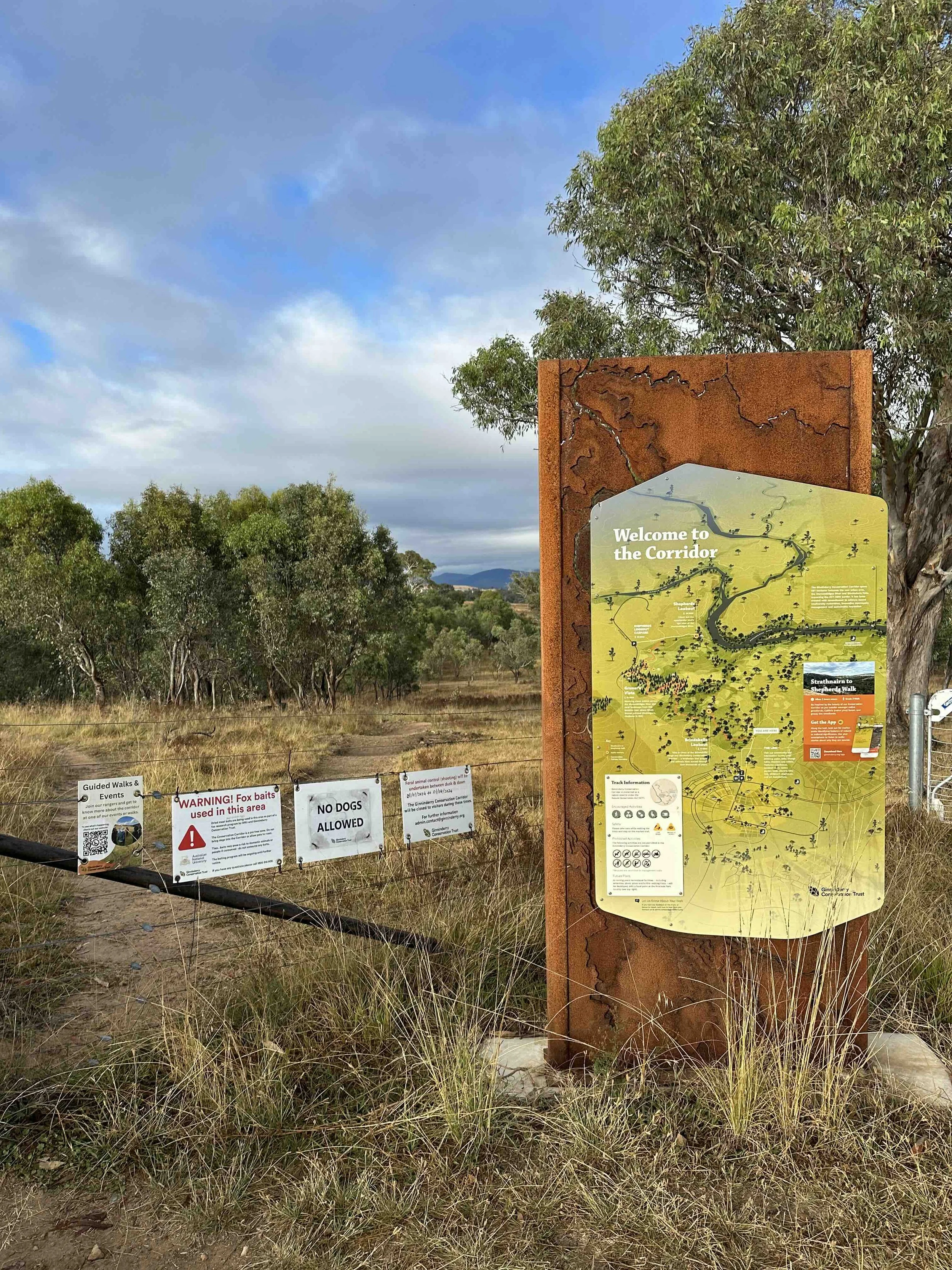

Illustration
This map design was constructed from scratch using Adobe Illustrator and InDesign, with the only re-used assets being the two rectangular information sections in the bottom left. Satellite imagery of the landscape, topographic maps and housing development blueprints were used as references to ensure geographical accuracy.
Interpretive Signage Development
Ongoing.
The next stage of the project involves determining what stories to share, and how to share them. Coordination with park rangers and ecologists, indigenous land-carers, and local history studies will generate information to convey to track walkers. User research will inform whether this is displayed physically through signage, or digitally through an interactive app.

User Research
(Ongoing survey)
A survey was developed and distributed around the nature reserve so local walkers could provide input on what type of interpretive signage they would find most useful.
Findings will inform signage direction and development.


Example response from another survey for rangers:
Gathering ecologists’ input for accurate and relevant information about the unique landscape.

Children’s Interp Ideation
Early sketching for an interactive interp for the “Kids’ Walk” section of the walking track.

“Natalie is a talented designer and project manager. She is creative, self-motivated, strong communicator and valued member of our team. The interpretation and wayfinding package she has delivered for our new walking track network is impressive and will be her legacy.
I would recommend Natalie for any project.”
— Angela Calliess, Program Director of the Ginninderry Conservation Trust.